Latin American Geographies: A Glance over an Immense Landscape
Cities and landscapes in Latin America are the result of three distinct yet interrelated processes.1 The first is its physical geography, which continues to be fundamental to its territorial organization, its cultural diversity, and its position as a major source of minerals, metals, and hydrocarbons for global markets. The second, a historical one, is that Latin America went through a process of colonization that was distinctly different from others, particularly in North America, one that implanted an extensive network of cities and a tradition of cultural hybridization, both still operative today. The third, a socio-economic one, and one of the most rehearsed hypothesis on Latin American culture, is that there has been a fully developed modernism, in the cultural sense of the word, but without full modernization, in the economic and social senses of the term.
Geography
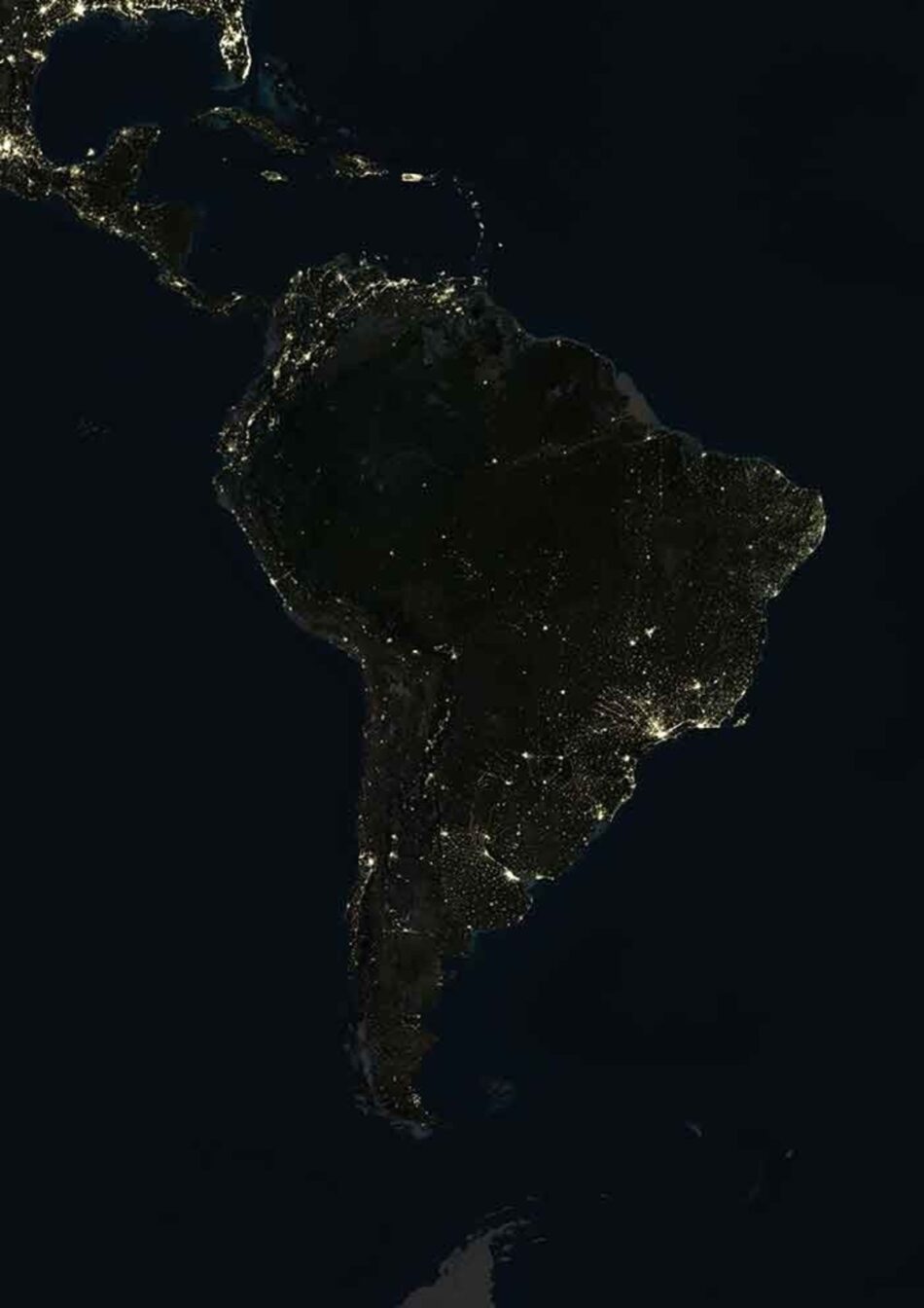
As with North America, it is impossible to describe the geography of Latin America without using superlatives. Its surface covers 8,134,980 square miles and spans from latitude 32˚ North to 56˚ South, and from longitude 117˚ West to 35˚ West—no continent has a larger latitudinal span. Along this length its climate changes from arid to tropical (with nearly 70% of its land mass in this latter category) to temperate to sub-Antarctic. Along its western edge are both one of the wettest places in the world (Tutunendó in Colombia, with 464 inches of precipitation annually) and the driest (the Atacama Desert of Chile, where in parts of it no rain has ever been recorded). Two primary figures articulate the continent’s interior: the Amazon forest (the most biologically diverse forest in the world) and the spine of the Andes (the longest mountain range in the world), which extends in a nearly straight line of more than 4,350 miles for the length of the continent. Extensive savannas, rainforests, and rivers characterize regions east of the Andes all the way to the Atlantic Ocean, while the continent’s western edge is characterized by the extreme topography of the mountainous chain as it fronts the Pacific Ocean. Cities are predominantly close to the coasts, while inland is mostly nature’s dominion, replete with wonderful and even unseen panoramas and bountiful resources. NASA’s image of the earth at night shot from space in 2000 remains fundamentally the same as the map drawn four-and-a-half centuries earlier by French cartographer Pierre Desceliers: Both show practically continuous settlement on the coast in contrast to a sparsely inhabited center.
Although colonized by the same imperial power, Spain, and sharing a religion and a language (with the exception of Brazil, originally Portuguese colonies, and Haiti, where Haitian Creole rules), Latin America’s formidable geographic barriers have prevented the region’s estimated 590 million habitants from being unified politically, economically, and culturally. The original territory evolved into twenty countries, each with its own historical and political trajectories and distinct cultural identities. There are also clear ethnographic differences. The southern cone (Chile, Argentina, Uruguay, and the southern part of Brazil) is characterized by a population of European origin in its majority, with a very small minority of native groups. The Andean countries (Colombia, Ecuador, Peru, and Bolivia) occupy the northwest region and have a more or less even distribution of mestizo, white, and native Indian population. The tropical region (Venezuela and Brazil) has a majority of mestizo and African American, and a white minority. Central America (from Panama to the US border) and the Caribbean include a majority of Amerindians, African Americans, and mulattoes, a result of trade and slavery practices in those areas.2
Colonization Through the Founding of Cities
The Spanish colonization of Latin America was strictly an economic enterprise. Competing with the rest of Europe to secure maritime routes and to control access to new commodities, Spain quickly developed a network of expedition routes that covered almost all South and Central America, and the south and west of North America, establishing an infrastructure of mining, agricultural, and port operations unrivaled in the world. The organization of this vast economic enterprise was enabled by the systematic foundation of cities. At least 911 cities were founded, from Patagonia to northern California and along the south and south-west of North America. Cities were conceived as a network of strategic points located mostly, but not always, around continental perimeters, as points of exchange or close to ports and mining resources.3 When it proved useful, the Spanish also appropriated cities and infrastructure built by pre-Columbian civilizations.4
The network itself was rhizomatic: It spread very quickly in a multi-directional search throughout a vast and previously unmapped territory, resulting in a system of isolated cities that were far away from each other, connected mostly by rivers, a few pre-existing roads, or the sea. The unifying institution in this disperse enterprise was the Catholic Church. As the sole patrons of churches, schools, missions, and hospitals, it was the primary agent of dissemination of Hispanic culture and language, of Christianity, of education, and of health care. Equally important, it was the primary economic agent of colonization. Acting as spiritual leaders and financiers, the Catholic clergy occupied positions of political andeconomic power: After the monarchies of Spain and Portugal, they were the continent’s biggest investors and landowners. Everything extracted—mined, harvested, or exploited—was immediately shipped overseas to satisfy European markets and ultimately expanded the economic and political power of the Spanish, Portuguese, and Roman Catholic empires.
The founding of the cities was ordered by law—the Law of Indies—an instrument that established authority and administrative power over the territory and its resources. The cities were organized, according to a pre-established plan conceived in the abstract space of the law and never drawn formally a priori: A grid extended from a central plaza around which was to be located the three powers of authority—the local outpost of the Spanish government, the church, and the governor’s residence. As foundational act, the plaza was both symbolic and performative: It marked the starting point of the city, of the processes of resource extraction and their administration, and of the expansion of Hispanic culture, and it reasserted the continuous presence of the empire throughout the territory. The plans of Bogotá, Santiago de Chile, Buenos Aires, La Havana, Quito, and Caracas, to name a few, are essentially the same.
The Law of Indies is a fascinating and extensive document that specifies all aspects of settling a city in an unknown territory in an ordered way. In addition to describing the size and proportion of the plaza and the layout of the street grid, the Law specified criteria for siting, the preferred elevation and exposure to winds, proximity to water, pastures, and good soils and forest resources. The Law also described ways to expand and shrink cities. From their inception, these cities were cases of “lite” urbanism and indeed, José de Oviedo y Baños’s 1793 Historia de la Conquista describes them as “ciudades portátiles” (portable cities), a concept compatible with our contemporary notions of dynamic urban environments.
As cities became important economically, they became hot spots in the enterprise’s network, not only growing in size but also supporting the construction of significant works of ecclesiastical and civic architecture. If they did not prosper adequately they would shrink, and some eventually disappeared. The network was also affected by the power struggles taking place away in European metropolitan centers—their influence on the colonies became temporarily diminished while those conflicts were being resolved. This process continues to this day—Latin America has remained in a relationship of economic dependency susceptible to the external cycles and dynamics of a laissez-faire economy at a global scale, with China, the United States, Germany, and Canada now heavily investing in the extraction of its resources.
Although all the cities have the same morphological origins, none of them looks like any other, because the original gridded configuration was adapted to the particularities of local topography. The grid of Buenos Aires on the flat expanse of the Argentinean plane is fundamentally different than the grids implanted in the Andean region, where the sites were constricted in valleys between large mountains. The plaza-church-grid complex was not only a very adaptable unit, it was also reproducible as cities needed to expand. In this case, a new plaza with its church would form the core of a new center, around which new arrivals of colonists would settle. Through the propagation of this unit, a poly-centered city would eventually form, each plaza-church forming the core of a new and distinct parish. This method allowed for the easy expansion of the original diagram while retaining the capacity for variations when adaptation to different sites and rates of growth became necessary.
Ways of intervening in the colonial grid were also fundamentally different depending on the topography of the territory. In extremely mountainous cities, such as Quito, new forms of urbanism were difficult to integrate with the foundational grid. Thus they were placed outside the historic center, one after another in a linear fashion, with little or no relation to the original fabric or to each other. In the case of a flat topography, once again as in Buenos Aires, the grid was over-written to allow for the insertion of modern urban infrastructure, such as highways, continuing the trace of the original grid, but forming a “new grid” at a larger scale that allowed the city’s expansion. In terms of their scale and atmo sphere, it would not be an over-generalization to say that Spanish colonial cities were intimate, houses forming a continuous façade along the street, with lush courtyard gardens in the interior of the block. Settlers often replicated the streets and architecture of their town of origin, most often located in the south of Spain. Only the capital cities of the vice royal ties—such as Lima, México City, Bogotá, and Buenos Aires—achieved grandeur and monumentality both in their architecture and in the scale of their urban interventions.5
Modernism without Modernization
The legacy of Spanish colonization cannot be over emphasized. First, the urban pattern established by the Spanish has remained largely unaltered. Sixteen of the twenty most populous cities in Latin America today had been founded by 1580.6 Second, even though independence altered the political process and redefined foreign relations, the economic conditions generated by colonization remained essentially unchanged. Latin America has continued to be largely dependent on foreign investment for the development of its economy. In the years immediately following independence, Spain’s competing powers—France, Germany, and England—quickly stepped in to initiate a second era of colonization. Likewise, after the shift from agriculture to global commodities (such as niter, copper, and oil) starting in the 1920s, the United States became the main patron and consumer of Latin America’s newly discovered resources. Third, the sociocultural legacy has been slow to evolve. Through their engagement with international trade, the elites remained cosmopolitan and updated with European and North American culture and continued to introduce new ideas and cultural practices into their homeland. Yet, while they adopted liberal capitalist ideologies for international commerce, they remained retrograde in their newly acquired political and economic power, retaining conservative social and labor relations domestically. As a result, in Latin America modernization, both as an economic and cultural condition, was asynchronic and uneven, not reaching all levels of society with the same consistency or intensity.7 Furthermore, it was intermittent, as economic conditions in the countries responded to global economic cycles. This explains why in Latin America, “traditions [are] not quite past and modernity not yet wholly present.”8
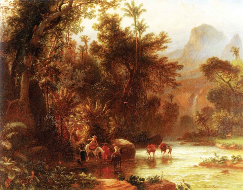
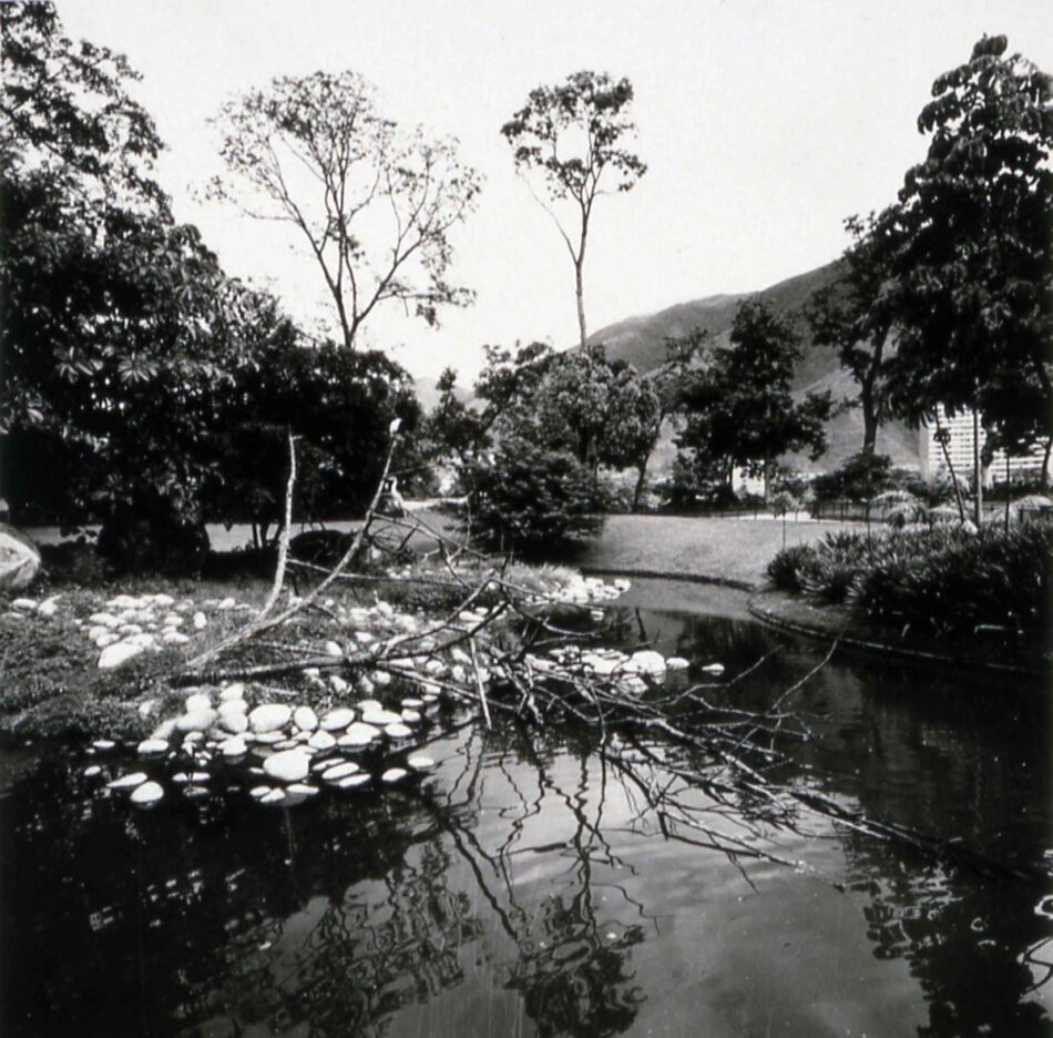
Few places register this process as clearly as the contemporary Latin American city, a collection of different forms of urbanism overlaid on or juxtaposed to the colonial grid. Cities changed their morphology and physiognomy depending on whom or what was stimulating their economy. For instance, Argentina’s economy thrived during the last decades of the 19th century as a result of an influx of British capital. The dominant model then, Haussmann’s Paris, heavily influenced the physiognomy of Buenos Aires. In contrast, Venezuela’s economic surge did not occur until the middle of the 20th century, when the United States was the dominant consumer for the country’s surging oil economy. The automobile, the super highway, and North American-style suburbs spread throughout the valley, while the spatiality of Modernism’s free plan oriented toward the outdoors became the norm in architectural and landscape interventions. Landscape is another lens through which one can understand the evolution of the Latin American city. Nature in the New World had been the object of amazement and astonishment for Europeans from the start. The chronicles of the first Spanish colonists are filled with descriptions of plants, vegetation, fruits, and indigenous people. However, the Latin American city remained the cleared space, literally and metaphorically, of colonization. Treeless and austere, it stood in stark contrast with the exuberant nature pressing against its edges. Landscape, as cultivated nature, did not become integrated into the physical environment of the city until the second half of the 19th century, when the discourse of modern science, Enlightenment, and Romanticism entered Latin American culture. France and Germany sponsored numerous expeditions to gain knowledge and access over resources previously monopolized by Spain. Scientists, naturalists, and explorers mapped and described almost the entire spectrum of natural phenomena and collected specimens of flora and fauna for museums, herbaria, botanical gardens, and greenhouses from Madrid to Saint Petersburg. Romantic painters and travelers extensively recorded Latin America’s natural, cultural, urban landscapes. These images of “objective” nature, devoid of all Spanish or religious traces, were significant because, in their appreciation of the native landscape, they reaffirmed the political aspirations of the new republics. Thus, in late 19th century Latin America, Enlightenment values, post-independence liberal ideology, and European commerce were in perfect alignment.
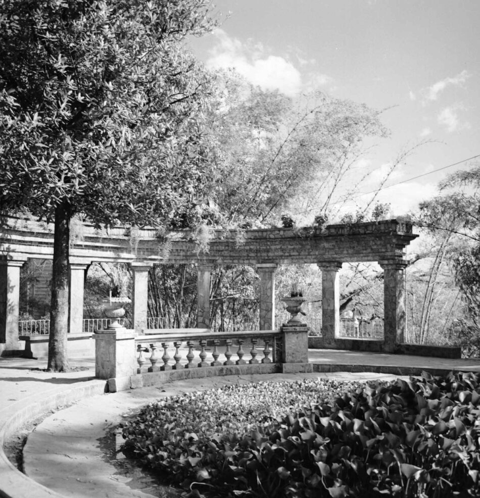
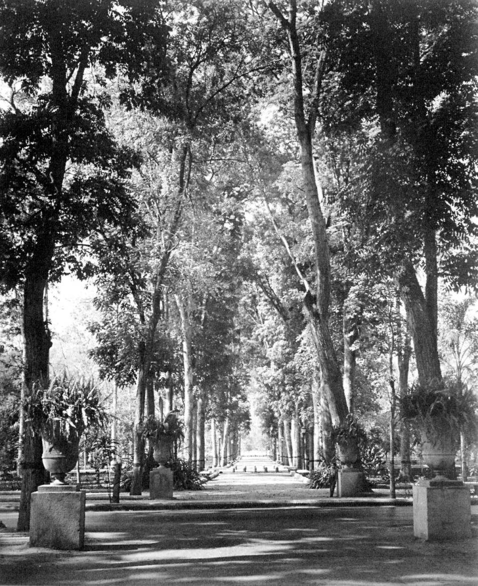
Not surprisingly, French landscape architecture was paradigmatic during the 19th century, with important works in Rio de Janeiro (Campo de Santana by Auguste Francois Marie Glaziou, as well as his renovations of public parks in the city), Buenos Aires (parks and gardens in Palermo by Carlos Thays and master plans by Jean-Claude Nicolas Forestier), and, early in the 20th century, in Havana (master plans by Jean-Claude Nicolas Forestier). During the middle of the 20th century, José Lluis Sert, Maurice Rotival, and Francis Violich, to name a few, introduced tools and practices of Modern planning in their planos reguladores for many capital cities. Modernism also informed the sensibility of a new poetics of tropical nature that found its most compelling expres sion in the work of Roberto Burle Marx. In most, if not all, countries, vast areas of land set aside in different types of conservation comprise the most recent trace left by foreign ideas on Latin America’s native soil. Approximately 12% of the continent is protected as national park or another designation.
The hybrid and dynamic nature of Latin American culture, the result of the processes just described, has been recognized as a fundamental aspect of its identity. The cross-pollination of local and foreign practices has been ongoing since the earliest days of colonization, when the Spanish appropriated native cultural practices, but it did not enter the artistic or literary self-conscious ness of the Latin American vanguard until the 1920s, as part of a project of constructing a national identity. Although this condition manifests itself differently in each country, producing forms of expression specific to the historical trajectories of each, hybridity has conditioned all spheres of cultural production throughout. As a practice, it entails looking at a wide range of material conditions, of elements and events, and reinterpreting from within in order to appropriate and make it one’s own. Because it disrupts accepted norms and continuities, this ongoing form of renewal also eschews the possibility of cultural essences. In this issue of HDM the reader will see different manifestations of transculturation, for example, in the combination of Modern spatialities and prog rams with highly textured or elaborated surfaces, a result of still-widely-available forms of traditional labor and materials. Similarly, the relationship between architecture and landscape (or city and landscape) continues to be conceptualized in ways that both respond to and generate new forms of engagement with the surrounding environment.
The vast extensions of spontaneous (“informal”) urbanization around metropolitan areas present the most recent geography to emerge in contemporary Latin America. Although the reasons for the proliferation of this type of urbanization are complex and not the purview of this article (see Harvard Design Magazine, Spring/Summer 2008), it is possible to cite the imbalance that has always existed between densely populated cities, as large administrative centers, and a very sparsely populated interior, a result of underdeveloped or non-existent regional economies. To greater or lesser extents, Latin American countries are still dependent on external markets for their growth and development, at the expense of smaller but more stable regional economies that can absorb the demands for jobs while promoting a more even distribution of investment in infrastructure and city regions. Finally, a new era of mining and resource extraction financed, once again, by foreign capital, including China, is about to begin, as conditions in Latin America favor the neoliberal global markets. These two contexts, which need extensive organization of new infrastructures and urbanism, present future spheres of intervention for architects, urban designers, and landscape architects.